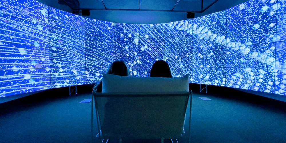
With the goal to increase public exposure to space traffic density, Dr. Megan Smith and PhD student Gao Yujie have created All the Stars We Cannot See, an immersive installation geographically situates participants in a virtual sky where they can gaze up in real time at over 25,000 satellites as they fly overhead. Smith and Gao are working to render visible the impact of satellite density in the sky, and to share information on the presence of technology surveillance globally.
This work helps to build opportunity for discussion on the impact of Space colonization, and bring awareness to the political and economic driving forces that are currently occupying Space, explains Megan Smith, Associate Professor of Media Studies in the Department of Creative Studies.
“One of the things that brought us to this project is the social media fever that is going on with so much communication and images transferring between people,” Smith notes.
People are constantly connected through their devices, so they wanted to ask some more pertinent questions; how is the use of this tech affecting us and how could they build upon that in some way.
“We looked up into the sky for answers, as we know satellites play a very active role in relaying our communications, and we wondered how many satellites are up there, anyway?”
There has been a massive growth of technology launched into space, and this project visualizes that content. The artwork is produced by pulling real-time data from N2YO.com using their Application Programming Interface (API). Once the real-time data flows into the program, they work with the satellite footprint – latitude, longitude and altitude formatted into decimal degrees. The data being pulled from the satellites is rendered on 30-foot rounded screens in the Visualization and Emerging Media Studio (VEMS) here at UBCO, so a viewer can sit in the space to really take in the entire experience.
“The first time we put our visuals on the big screen, my perception of the project scope changed. It felt like all these satellites were coming to you and I was surprised to enjoy the moment of moving through the screen with the satellites,” says Gao.
She adds, that it is hard to explain how incredible it feels to be surrounded by this satellite data.
The hope for this project is that it will push audiences to ask questions about what is happening in space, as installed in the VEMS it gives us that wow factor that a starry night sky can provide. It is all encompassing feeling of awe.
“We want this to be a pathway to touch outer space so we can begin to understand impact of satellite density, potential surveillance, and the political and economical driving forces that are currently colonizing this new frontier,” says Smith.
This geographic data is stored within individual pixel R.G.B data to a lossless image – where each pixel of the image contains specified position data for a satellite at a specific moment. The data is updated every 15 seconds and enables the viewers to identify movement.
This work was presented at EVA London 2021, and Technarte Bilbao 2022, and on campus in the Visualization and Emerging Media Studio (COM 107).
Megan Smith and Gao Yujie provide this synopsis of some of the research:
View this lecture from the Technarte Conference, in February 2022:
About the Artists and Researchers
Dr. Megan Smith is a UBC 2022 Killam Laureate, Associate Professor in Creative Technologies in FCCS, and director of the Masters of Design program. Her practice-based research probes systems for delivering syndicated data through narrative structure and she often works with virtual and augmented reality, geo-location, live-feed installation, and performance as methods for storytelling.
Gao Yujie is a graduate of the Digital Arts and Humanities theme in the Interdisciplinary Graduate Studies program at UBCO, and now teaches in the Media Studies program in FCCS. Her generative participatory performance work studies the materiality of duration and explores the elasticity of space and time in rule-based interactive environments.
